Setting new standards with UAVs
Applications for commercial use of Unmanned Aerial Vehicles (UAVs) have surged in recent years and most industry sectors are becoming aware of the benefits that this technology can bring to them on many fronts.
One significant application that UAV technology can be applied to is volume calculations. For example, when industrial operations require stockpile volumes to be calculated, traditional surveying is no longer the only option.
Using fixed wing and multirotor UAVs, Harrier Surveys has developed an expertise in delivering accurate volume measurements of targets with complex geometries.
How is this achieved?
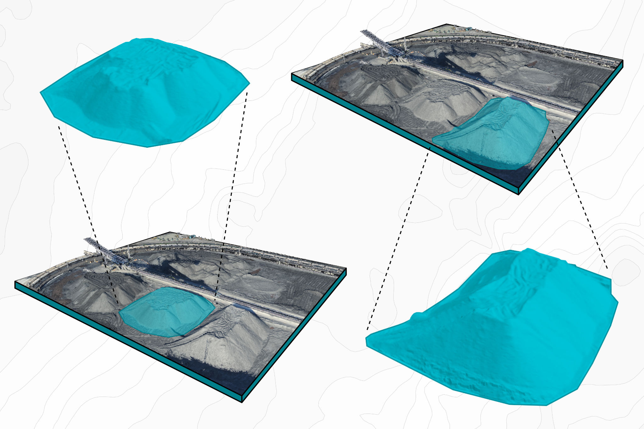
With overlapping imagery acquired from commercial grade UAVs equipped with high resolution cameras, we produce highly accurate 3D models of our project targets thanks to sophisticated digital photogrammetry software.
From these 3D models, volumes can be calculated to at least the same degree of accuracy and precision that can be achieved using traditional survey techniques or lidar but at a much higher resolution.
Multirotor or Fixed Wing?
Harrier Surveys is well equipped to deliver volume measurements for any type of project, regardless of size and location, thanks to our fixed wing and multi-rotor UAVs. Fixed-wing UAVs are most suitable for larger projects because of their greater flight range whereas multi-rotor UAVs are useful for smaller projects and confined spaces.
Unique perspective, reduced interruptions
UAV survey methods present clear advantages over traditional ones. For example, while an eight-hour traditional survey will collect 1,500 data points to describe a stockpile, a UAV survey will create 15,000,000 data points from a 15-minute flight.
Our ability to quickly capture data from a distance provides a more accurate snapshot of the target, especially when piles are constantly changing, eliminating the need to shut down stockpile operations during the survey.
So, what’s the bottom line? Safer. Faster. More cost effective.
Surveying a stockpile in complex terrain can be time consuming and present serious safety concerns. However, thanks to the perspective that UAV technology offers, our crews doesn’t need to travel through the whole project area to capture the required information.
This means we don’t spend as much time out in the field and that our work can be conducted more safely than a traditional survey team, especially for large projects, translating to a more cost-effective solution.
Diagram of Calculating Volumes